WHERE THE SIDEWALK ENDS
Abstract
"Where the Sidewalk Ends" is a study on living sidewalks that treats city immersion as a research method. Rather than beginning with maps or archives alone, the project begins by walking, using maps and photography to tie historical research to city design and to examine how art forms in cities, from painted hopscotch courts to murals, operate as an understanding of community needs and changes. What began as a single-neighborhood study widened into a more comprehensive look at sidewalk art across San Francisco and the Bay Area, and at how people use the street as language. Research moved between the archive and the street: historical maps and newspaper records established how these neighborhoods' urban fabric was formed, while on-the-ground observation and photography documented how that fabric is used, adapted, and rewritten today. Direct community engagement with residents and passersby, asking about their daily routines and where those routines unfold, grounded the study in what people actually need from their streets, translating lived patterns into design needs. The paper argues that art can represent living identities in cities, and that youthful movement through public space is one of the clearest signals of where a neighborhood feels walkable, safe, and shared.
Actionable Methodology
- 01Treated city immersion as a research method: walking, photographing, and mapping streets across San Francisco and the Bay Area sequentially so the analysis captured how a place unfolds over time, not just how it looks from above
- 02Read art forms in the city (murals, chalk games, painted play streets) as evidence of community needs and changes, using them as primary sources that reveal who a street is designed for and who claims it
- 03Engaged directly with community members about their daily routines to understand what their design needs are, grounding historical and photographic analysis in lived patterns of movement, pause, and gathering
Context
Maps, whether analog or digital, cannot relate the actual experience of passing through a landscape in which elements of a place are experienced sequentially, each one impacting how we interpret the next. San Francisco and the wider Bay Area, layered with generations of immigrant, artistic, and working-class histories, offer a dense setting to test how a city's design is carried not only in its buildings but in its sidewalks: how spaces feel most walkable, and how that reveals itself in the landscape.
Method
The research combined three modes of city immersion. First, historical mapping and archival reading traced how Bay Area streets, alleys, and public spaces were formed, using maps and photography to tie historical research to city design. Second, photographic documentation treated art forms in the city (murals, chalk games, painted play streets, signage) as primary sources, examining them as an understanding of community needs and changes over time. Third, direct community engagement placed conversations with community members alongside observation of their daily routines, asking where people walk, pause, and gather, and using those rhythms to understand what their design needs actually are.
Findings
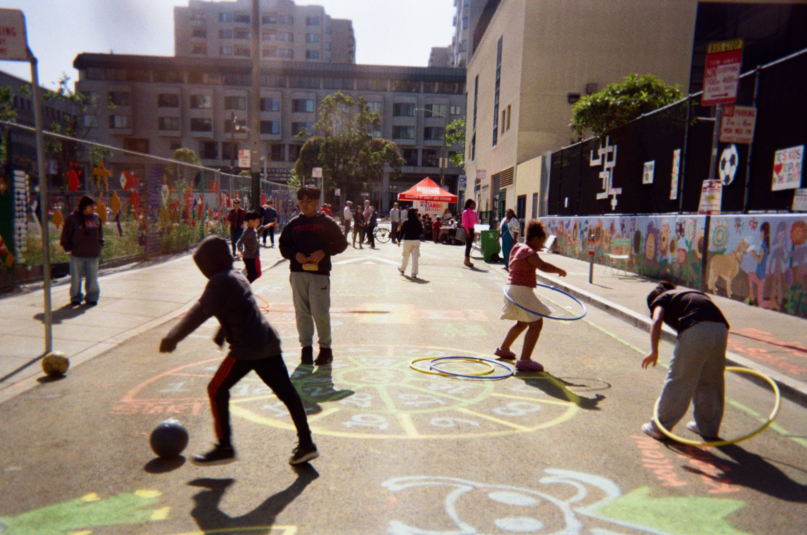
The streets that read as most alive were those where residents had left their own marks on the public right-of-way: play streets painted with games, murals claiming walls for neighborhood memory, and informal gathering spots carved from leftover space. Where the design of the street supported youthful strides (children's movement, wandering, lingering), the neighborhood registered as walkable and shared; where sidewalks narrowed, sped up, or emptied, the street read as passage rather than place.
Implications
Reading sidewalks as living documents suggests that city design should be evaluated not only through counts and codes but through the art and routines communities inscribe in public space. Designers and planners can use photographic and ethnographic observation of everyday art as a low-cost, high-signal method for identifying where a city's design is serving its residents, and where it is ending before it reaches them, at the place where the sidewalk ends.